So far I’d already had a productive morning. I had visited the ruins and cemetery of the Old Lebanon Presbyterian Church. I would have been satisfied with just that, but I still had time on this beautiful Thursday, and there was much more to see. I would spend a good bit of time chasing GPS waypoints, and zig-zagging across the lower part of Fairfield County.
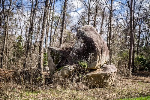
While driving through Fairfield County I saw lots of examples of buildings made from the Winnsboro Blue Granite, the state stone. I also spotted several dramatic boulders of granite.
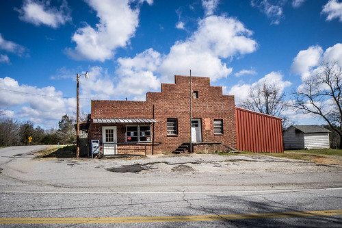
I reached the small community of Rion. There I found a defunct post office that had probably also been a country store.
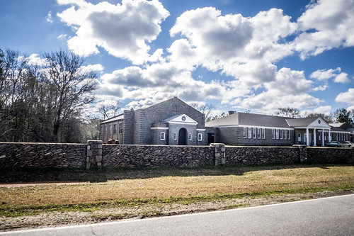
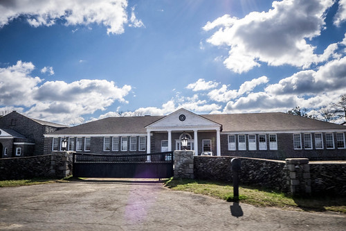
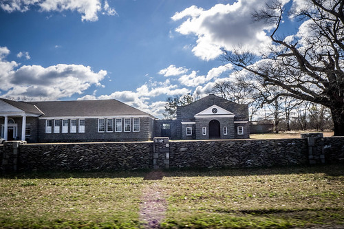
Not far from Rion is the Fairfield County Airport. There seemed to be lots of helicopter activity. Across from the airport I found my next target. Greenbrier School was built in 1940, but has now ceased as a school. I couldn’t find a year for its closure. The school is on the National Register of Historic Places as part of the Rockton and Rion Railroad Historic District.
As I drove by the school I could see that it’s very well maintained, but it’s also now a private residence. The architecture is classic, with a central wing flanked by an auditorium and gym on either side. However, instead of brick, the buildings were constructed of Winnsboro Blue Granite. I had to wonder what it would be like to live in such a building. How would you utilize spaces such as the gym and auditorium?
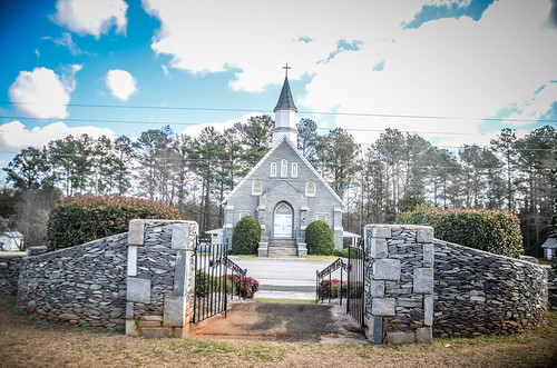
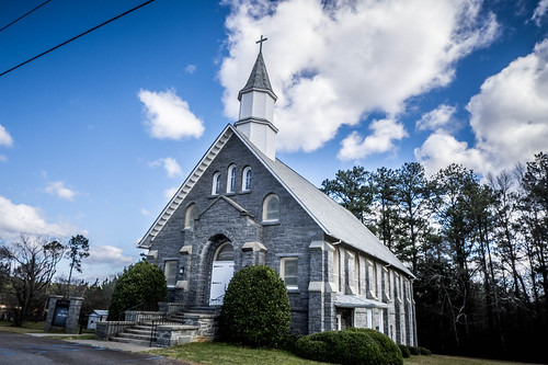
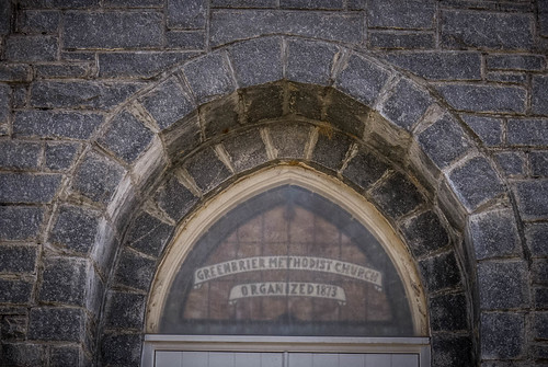
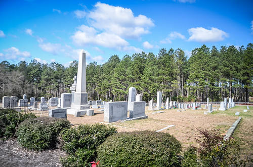
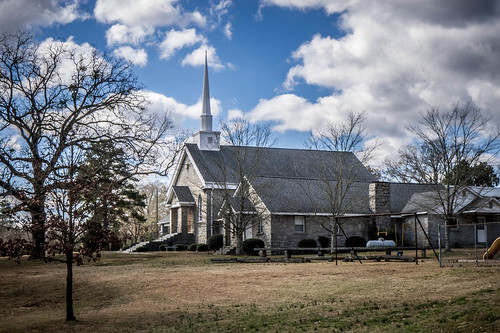
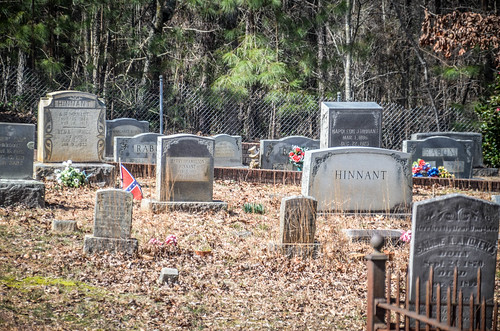
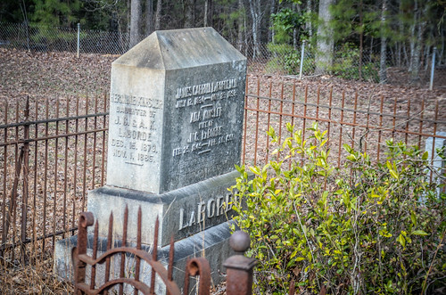
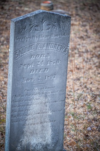
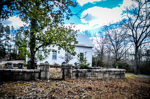
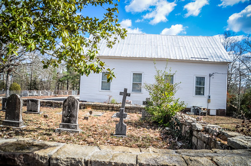
Around the corner was Greenbrier Methodist Church, also from the blue granite. The cemetery looked like it was mostly 20th century, so I didn’t explore too much.
From there I began the zig-zag part of my trip. Ultimately, I wanted to wind up in Ridgeway, which was to the east. However, when I punched up the next point of interest (POI) on my GPS, it was to the west. Not really thinking about it, I headed in that direction. I wasn’t using the best navigation skills on this outing.
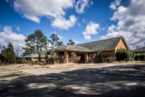
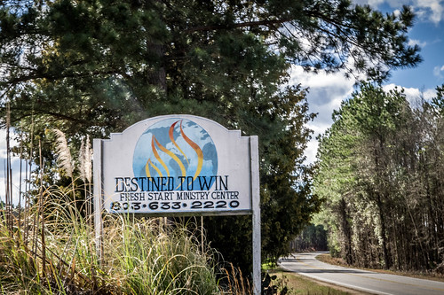
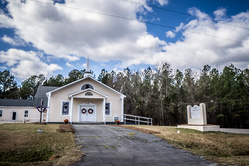
Just south of Greenbrier Methodist was an unusual facility. At first glance I thought it might have been an old school, but upon closer inspection it looked like a motel. A motel in this remote part of the world with no major road nearby? Nah, it had to be something else. I figured it might have been an assisted living place at one time. The sign said “Destined to Win Fresh Start Ministry Center”, but it was obvious from the overgrown landscaping that it hadn’t been used in a long time.
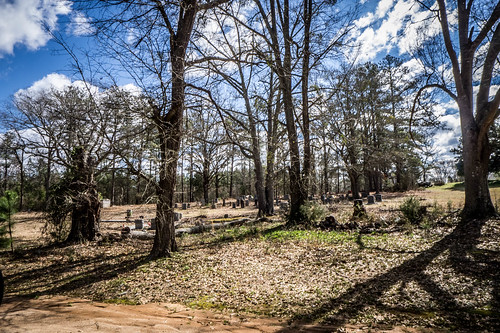
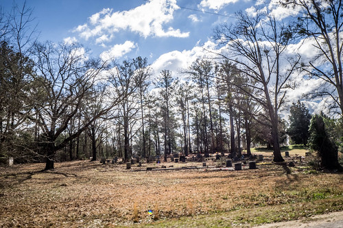
Beyond that was a rather large cemetery with no church nearby. I took a photo from the road, but there were people on either side of the plot, and there were No Trespassing signs. GNIS indicates that this was once the site of Ebenezer Church.
I came across several unmarked cemeteries like this along this stretch, but didn’t stop. I would catch a glimpse of one or two headstones off in the woods in a private family plot. I was surprised at how many I passed.
The next POI I had marked was another one of my favorite Biblical names for churches – Shiloh. Normally GNIS data has the indicator “(historical)” next to buildings that are no longer extant. That wasn’t the case with this church, but neither could I spot it in Google Earth. I took the little loop road that was supposed to take me to the church, and found mobile homes on the property instead. Oh well.
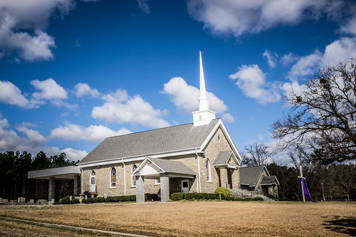
Just a mile or so west of the Shiloh site was yet another old Biblical name – Bethel Church. This was a very active Methodist church set off the road a bit. It was constructed of Winnsboro Blue, and had a large cemetery. I drove around the church, but didn’t get out at the cemetery.
For some reason my POIs seemed to be taking me further west, even though I knew I needed to go east. The next one I had marked in the GPS was Rock Hill Church. An online friend had posted a photo of it in a Facebook group, so I decided to check it out. Along the way, though, I spotted another interesting church that I had not marked.
Saint Matthew Church didn’t have interesting architecture or a historic cemetery. In fact, it was fairly unremarkable. It caught my eye because of its name – Saint Matthew First Baptist Church. This begs the question, First Baptist of what?? I was in the middle of nowhere. There were no towns nearby of which the church claim the status of being “first.” I guess they just thought the name sounded cool.
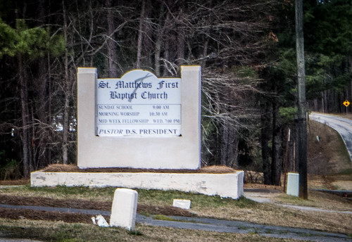
I must say, though, that the church I grew up in was “Laurens First Pentecostal Holiness Church”, even though it was the ONLY PH church in Laurens. I guess, technically, that did make it “first.” This business of numerical naming of churches has always intrigued me, almost as much as old Biblical church names.
Rock Hill was a white framed church that for some reason didn’t hold my interest. I didn’t post a single photo of it. To be honest, I think I was getting a bit “church weary.” I was ready to see something else. The next nearest POI was, you guessed it, further west, and was the location of a potential ghost town along a railroad track.
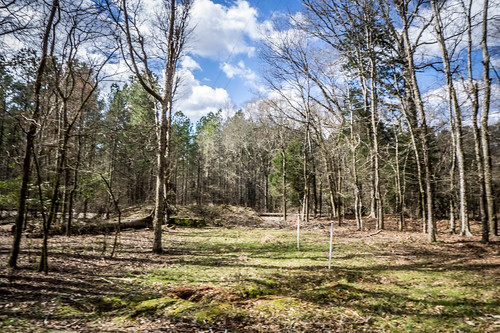
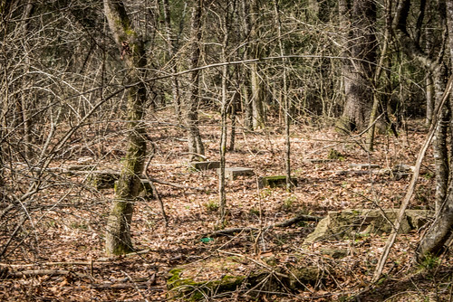
I spotted the name Wallaceville along the railroad next to the Broad River, and for whatever reason it caught my attention. GNIS indicated that there had once been a school in the community, but it was long gone. The town itself was at the end of a road that ends at the railroad.
Finding the POI wasn’t a problem. I turned down the road and followed it through a farming community to its end. It was just wooded rural South Carolina – nothing particularly notable. I did spot a series of foundations that may or may not have been the old depot.
When I got back home I decided to check Chronicling America to see if there were any references to the town. I found the usual “who’s visiting whom” in various papers, but the most interesting was a piece from 1895 in the Winnsboro News and Herald…
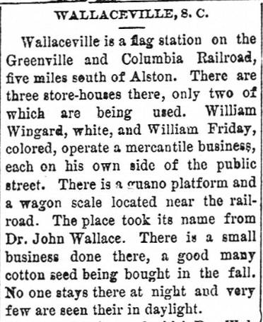
Wallaceville is a flag station on the Greenville and Columbia Railroad, five miles south of Alston. There are three store-houses there, only two of which are being used. William Wingard, white, and William Friday, colored, operated a mercantile business, each on his own side of the public street. There is a guano platform and a wagon scale located near the railroad. The place took its name from Dr. John Wallace. There is a small business done there, a good many cotton seed being bought in the fall. No one stays there at night and very few are seen their [sic] in daylight.
Apparently Dr. Wallace wasn’t too keen on the town that bore his name. In the article he described it as “being on its last legs” and “he knew the d—d [sic] railroad had killed it.” There certainly wasn’t any commercial activity visible when I visited. According to Find-a-Grave there is a historic cemetery in the area, but I was unaware of it until later.
Wallaceville was the westernmost point of interest in my GPS collection. It was time to head back east. Lunchtime was quickly approaching, and I had spotted a couple of places in Ridgeway that might be nice stops. I plugged the town name into my GPS and took the most direct route.
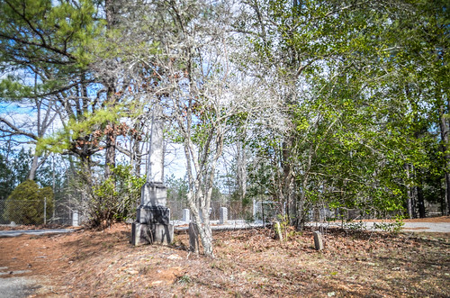
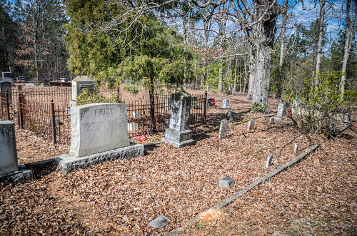
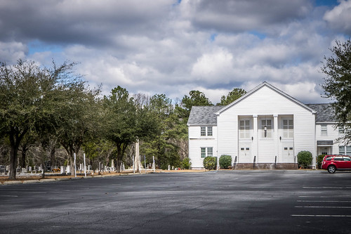
I headed south on 215 and crossed from Fairfield County into Richland County. At the Cedar Creek Community my route took me onto another rural road. About a half-mile from that intersection I spotted Cedar Creek Methodist Church. It was a small white-frame structure with an interesting cemetery, so I decided to check it out.
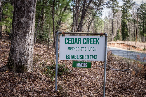
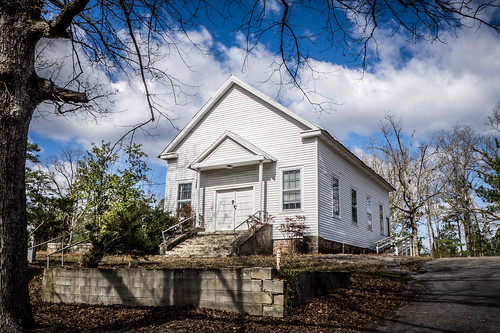
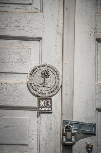
Kevin Dietrich over at The Cotton Boll Conspiracy has some interesting history about the church. According Dietrich, the church still has an active congregation…sort of. It only has one member, and the Methodist conference still sends a minister once a month to hold services. Dietrich’s reasoning is that the Methodists aren’t going to close a church that was founded by Francis Asbury himself.
I continued on my trek. At some point I crossed the geographic boundary between the Piedmont and Sand Hills. The soil had definitely turned sandy, and there were more pines than hardwoods. I crested a couple ridges where I could see off into the distance.
Eventually I reached the town of Blythwood. A brand new modern high school and multiple housing developments attest to this being a bedroom community for Columbia. I pulled in for one shot at Sand Level Baptist Church.
To be honest, I was surprised that there was an actual Main Street. I couldn’t exactly call it a town center, but there were a few older buildings. Even so, I didn’t stop for any more photos. I was ready to make it to my next stop. However, I’ll save that for the final blog post in this series.