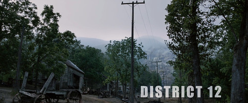
It has been tradition for Alan Russell and me to take a photo excursion on Martin Luther King, Jr. Day. This time we decided to make the trek up to North Carolina and visit the Henry River Mill Village. This choice ticked lots of boxes – it’s a ghost town, and it served as the shooting location for “District 12” in the movie The Hunger Games. It turned out to be a day that went beyond expectations.
I’d seen plenty of photos of Henry Mill Village. With its recent popularity it has become a Mecca for fans of the film. As such, it’s also become the target of vandalism. I’d heard that most of the village was off-limits, except for what could be seen from the road. I honestly didn’t know what to expect, but I didn’t get my hopes too high. I put together a Google Map with other possible targets. I am completely unfamiliar with this part of North Carolina, so I wanted a few clear options, rather than driving around without a clue should the mill village prove to be a bust.
We had actually planned this trip for election day, when it seemed appropriate to visit the location of a dystopian movie. That trip fell through, so we rescheduled for this week. Again, dystopia seemed appropriate for the week of the inauguration.
And it felt dystopic. Politics aside, it was overcast and misty when Alan and I set out. The two-hour drive up was not inspiring – rather dull Interstates and four-lanes most of the way. As we drove further north the mist increased, but it didn’t rain outright. We took I-85 from Greenville to US 321 in Gastonia, then I-40 back west to Hildebrande. The village itself was just a couple of miles off the Interstate.
Before we get there, though, a bit of history is in order…
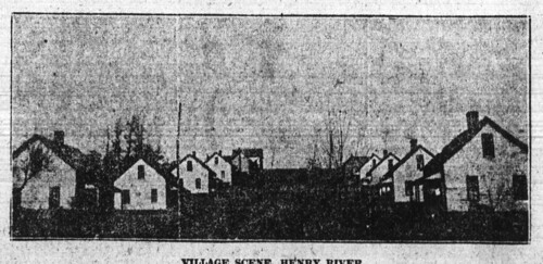
Three Rudisills (Michael Erastus, Albert Pinckney, and Miles R. ) and two Aderholdt brothers (David William and Marcus Lafayette) got together and formed the Henry River Manufacturing Company in 1904. By 1905 they had constructed a 4000 spindle yarn mill and a 30 feet dam to provide power to the mill. In addition they built a planned community to house the workers, which included the company store and 35 cottages. The images of the mill are from the “Images of America: Henry River Mill Village” book.
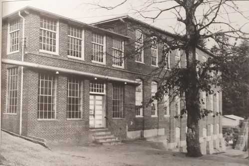
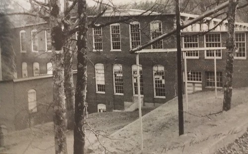
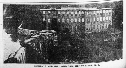
By the time it shut down in the late 1960s, the mill had 12,000 spindles and produced fine combed yarn for lace. The mill closed in 1973, and in 1977 the mill burned, leaving only the cottages and company store. Of the original 35 mill houses, 20 have survived.
The property was purchased in 1976 by Wade Shepherd, who hoped to redevelop the site. In 2010-11 Shepherd allowed Lionsgate Films to use the village as the location of District 12 for The Hunger Games. Shortly thereafter, Shepherd put the property up for sale for $1.4 million, hoping to capitalize on the sites new-found fame. Shepherd had tried to keep trespassers out of the village because of repeated incidents of vandalism, and at the age of 83 he was getting tired of it. In 2015, Wade Shepherd died, and the future of the village is now up in the air.
Back to the trip…
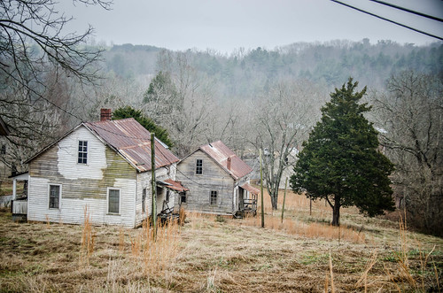
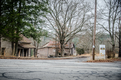
Driving down Henry River Road I was surprised at how many structures were visible from the road. When we reached the company store that marks the heart of the village there were several parked cars. Not know what was really going on, we drove on past first. We crossed the Henry River on a high bridge, turned around, then came back to the store. I decided to pull on in next to one of the parked cars.

Last time I pulled up to a mill store like this the cars were parked outside for a meeting. I didn’t know if this was the case here, or not. A couple approached, and I asked if they were associated with the site. They said they were just there looking around. We figured that’s what everyone else was doing, too, so we decided to explore.
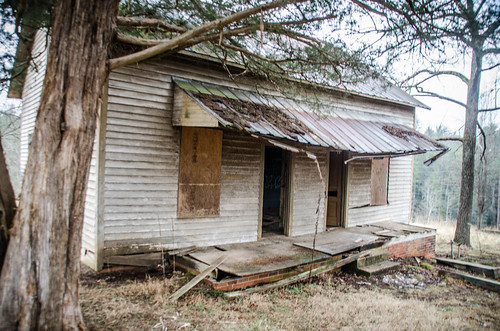
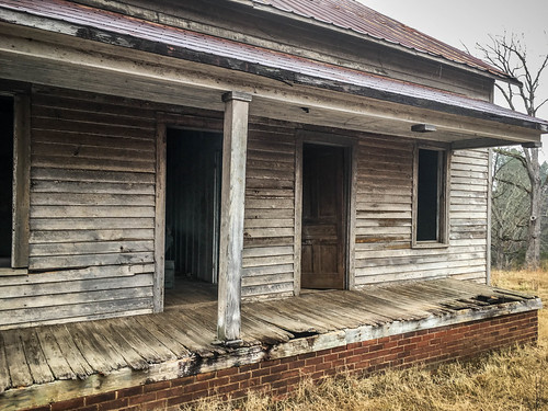
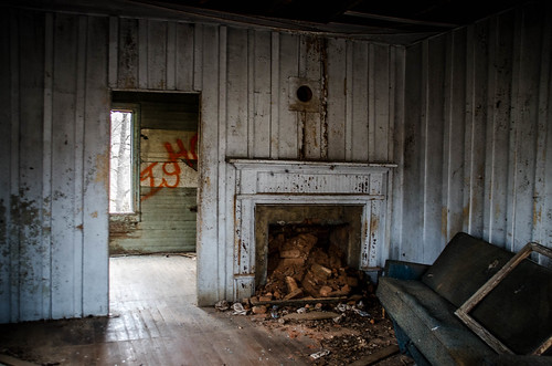
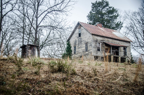
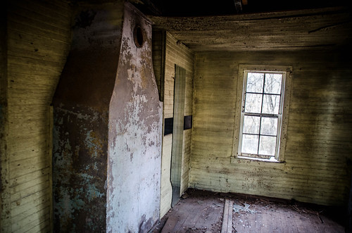
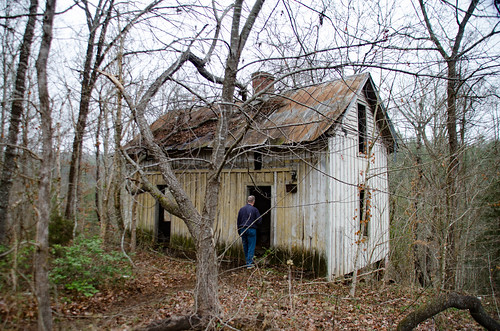
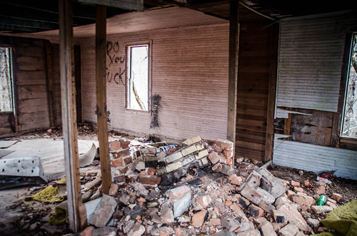
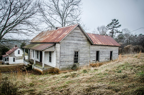
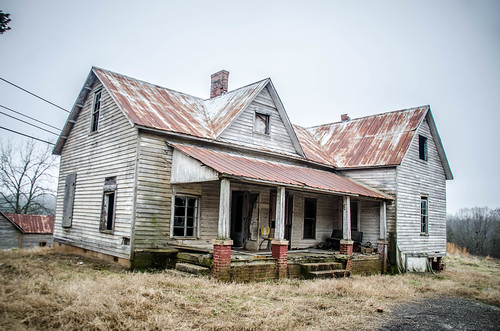
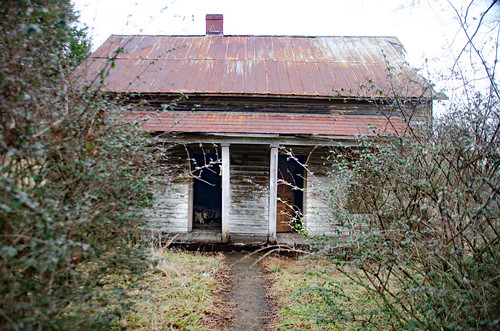
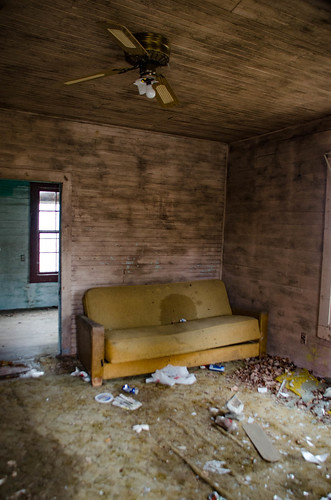
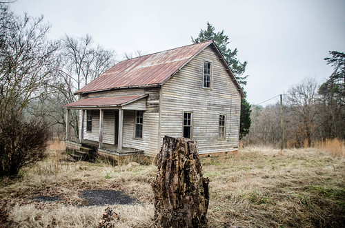
We didn’t see any No Trespassing signs, and since there was a Burke County Museum sign about The Hunger Games, that seemed like an invitation. We started with the house directly across from the store. It seemed to be in the best shape. The door was open, so we went on in.
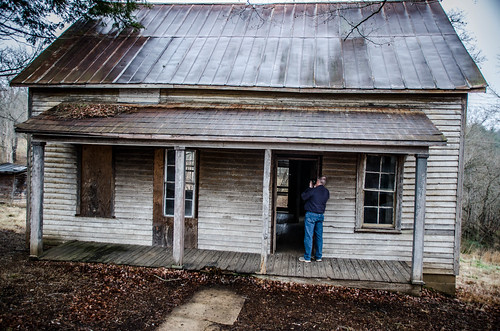

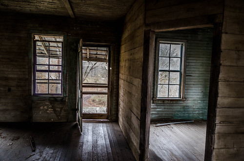
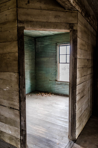

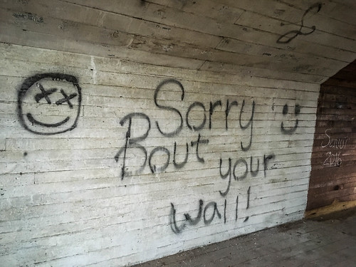
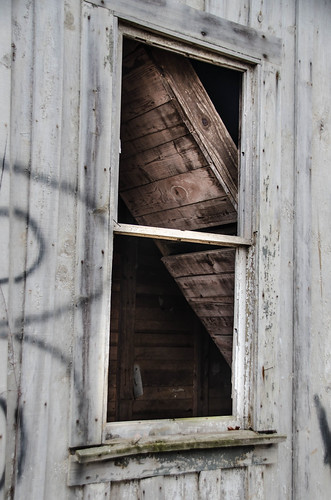
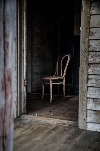
The upstairs had been heavily vandalized.
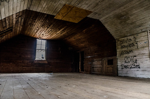
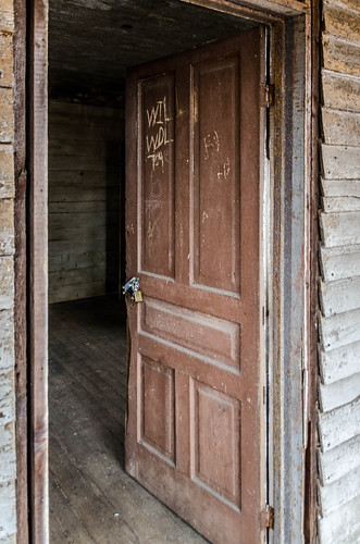
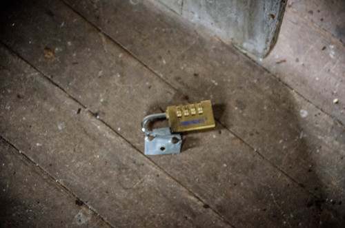
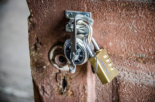
Back downstairs it was apparent that this house was supposed to be off-limits. There were multiple padlocks on the door, and it looked like the door had been kicked in – there was another padlock on the floor.
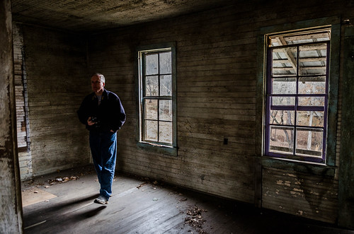
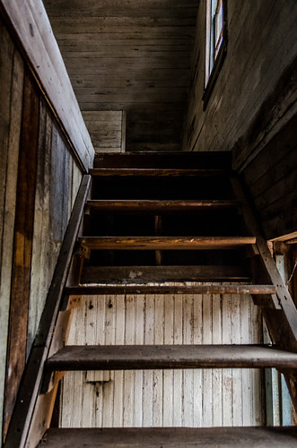
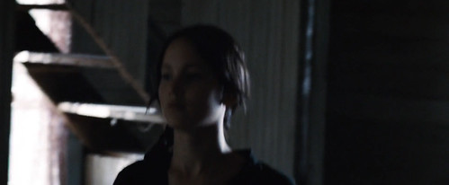
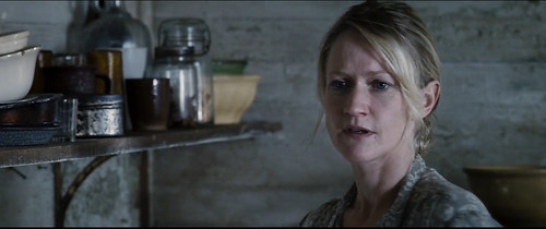
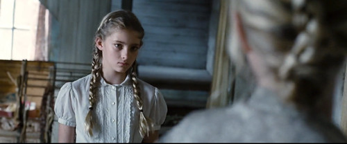
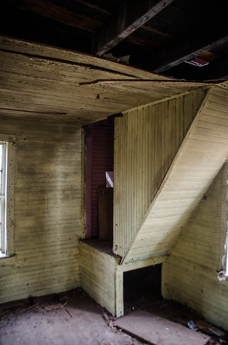
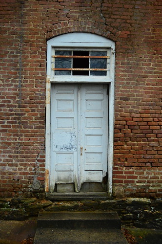
It wasn’t until I got home and re-watched The Hunger Games that I realized this must be the house used for many of the interior shots. Here’s a picture of Jennifer Lawrence, aka Katniss Everdeen standing in front of a set of stairs:
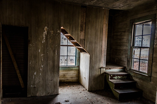
Here’s that same set of stairs in the house we were in:
I read in one account that the houses were already in pretty bad shape, and that the movie studio had to do some rebuilding to make them believable as houses.
This 1966 image identifies the house as belonging to one of the Rudisills, and it looks like it wasn’t in great shape even back then.

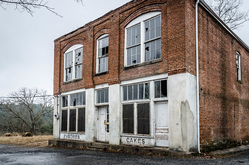
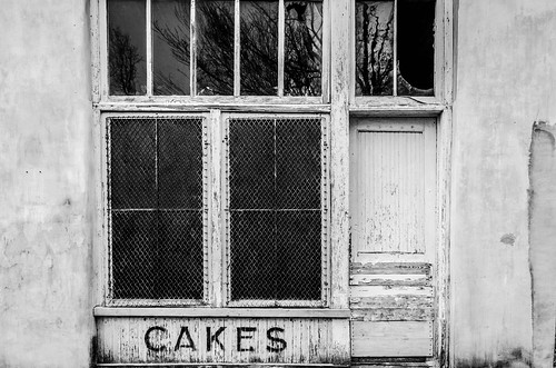
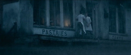
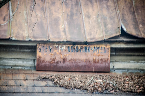
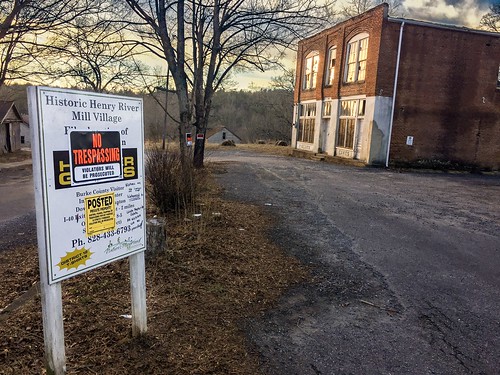
We turned our attention to the store across the street. It still had painted signs from the movie advertising Pastries and Cakes.
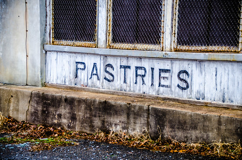
In the movie there was a wooden porch. I don’t know if that was original to the structure, or an add-on. It’s now missing, regardless. The movie only showed the lower floor. Here’s that shot…
…and my shot from a similar angle.
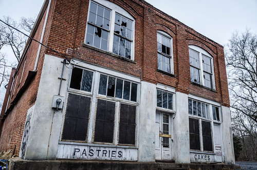
This was the only image I could find in the Images of America book, and it doesn’t show the wooden porch, so I’m guessing it was added for the movie.
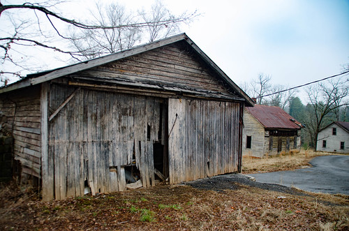
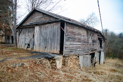
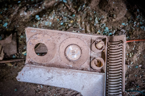
Below the Rudisill/Hunger Games House was a garage. There were two ramps over a steep decline so that mechanics could get under the car.
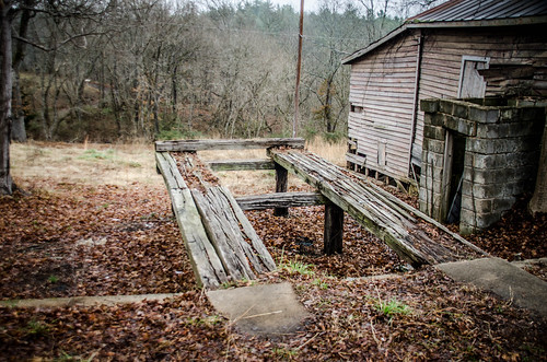
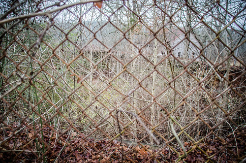
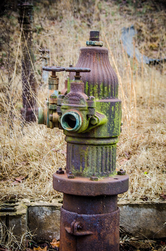
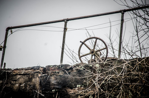
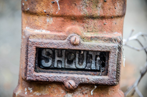
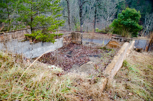
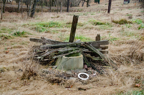
There was a pool or pond of some type, with various valves and hydrants below.
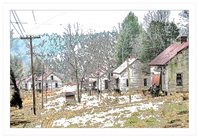
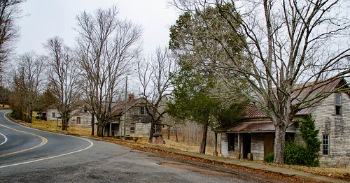
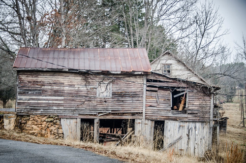
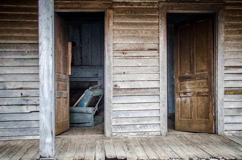
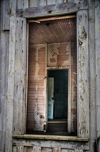
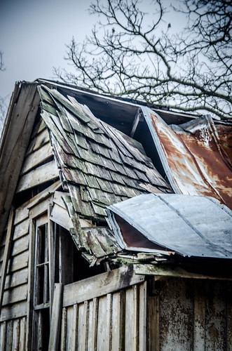
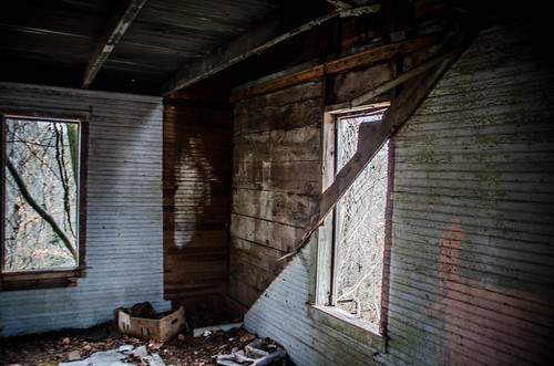
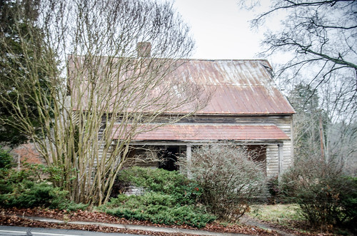
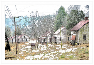
There were several other cottages, some in pretty bad shape. There were also interesting views back along the row of mill houses.


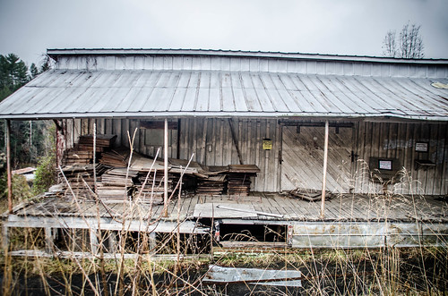
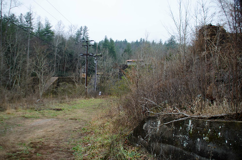
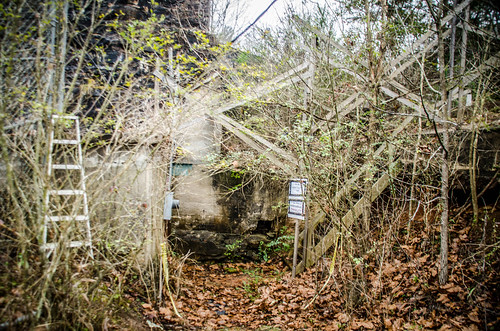
The street wound down close to the river. We could see the dam and an old warehouse building. There was a sign stating that the building was posted, and not part of the tour. We wondered, what tour?
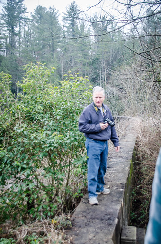
There was a pickup truck near the warehouse, and we spotted a man coming across the dam, then up to the truck. It could have been another visitor violating the posted signs, for all we know. When he got close, we ask if he knew anything about the old mill. That was our first interaction with Joe Cline, who would be our tour guide for the next bit of our trek.
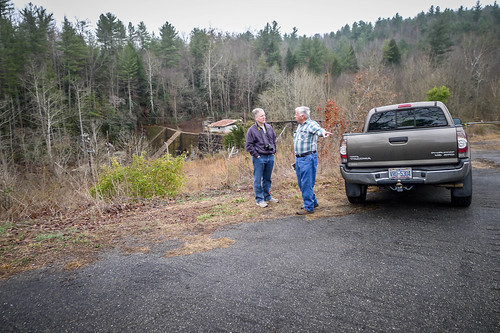
I immediately pulled out my audio recorder, mainly because Mr. Cline was giving us information so fast and furiously that I was afraid I’d miss some of it. Here’s a sample of his introduction to us:
My parents worked in the cotton mill. I was raised here…I was six years old…back up the hill, the last house up there on the right. We moved when I was six years old… was in first grade.
My parents continued to work down here for a number of years. People started moving off. Business, I think, got bad, and, Miles [Aderholdt?], that owned it, he’s getting up, probably in his 70s…I don’t know if he got tired of fooling with it, or what…but they closed in early 70s.
People continued to live here – a few couples did – until the early 80s. I think the county condemned the houses they had to move.
Somebody burned the mill down in ’77.
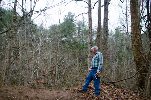
Cline pointed out the original outline of the mill.

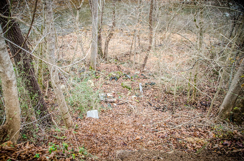
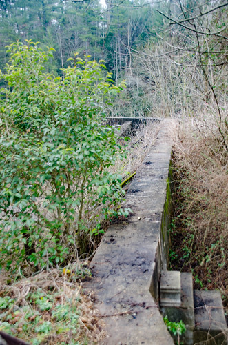
He also pointed out the location of the old bridge. Built in 1916, this was a single-lane bridge high above the Henry River. It must have been terrifying.
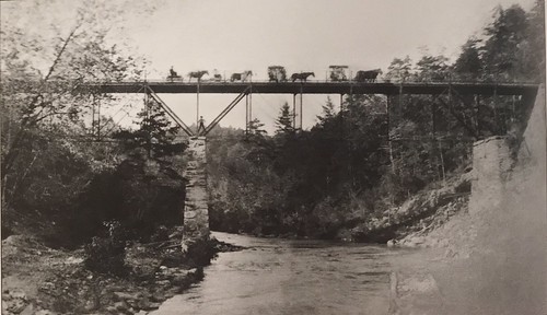
The new bridge was build in 1960, and this one was torn down. Now there was nothing be a dirt ramp into space, over a deep ravine where people had dumped stuff.

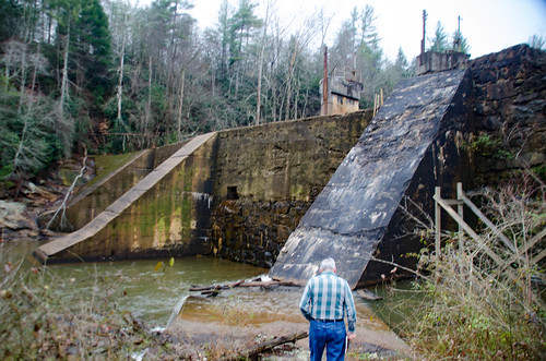
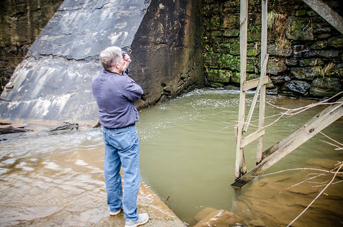
Cline led us down toward the dam, describing features of the mill along the way. He also described how he has been working to take care of the property, and his concern about its future. The areas he led us into were also marked as No Trespassing, but we figured that as long as we were with Joe it would be OK.
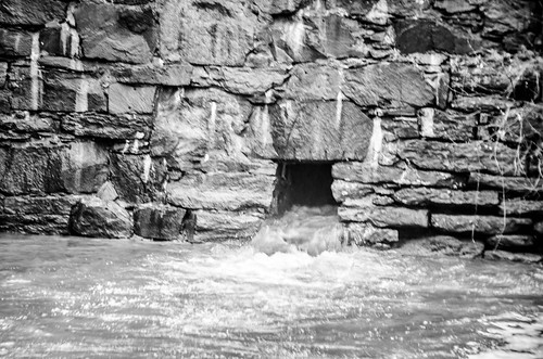
We reached the base of the dam and Cline talked about power generation. He said that another company still owns the dam and hopes to start generating power again. I confirmed ownership on the Burke County GIS site. The website also shows Wade Shepherd as the owner of the village. I’m sure that means that the estate still owns it.
But, back to the dam…it was very slippery, and I can understand why they want to keep people out of this area.
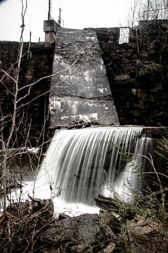
Once again I was able to find a shot from the movie that lined up with our current view. Here’s a photo I took…
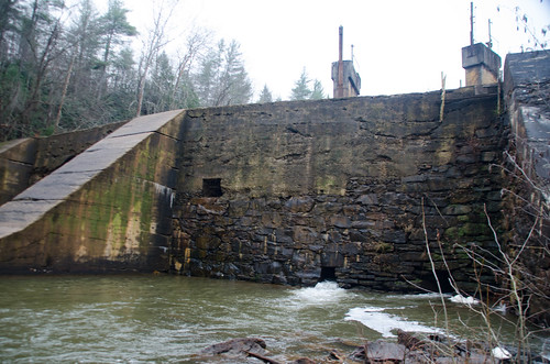
…and here’s Jennifer Lawrence running across the top of the dam.

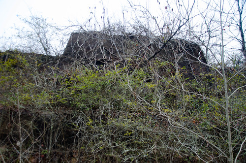
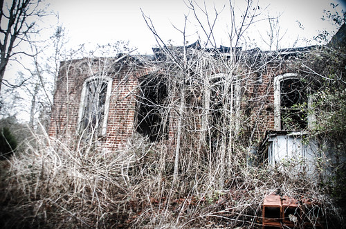
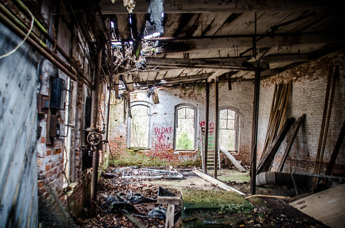
We made our way back up to another building near the top of the dam. It had dramatic arched windows, and was used to store cotton bales. Joe showed us where the bales came through a sliding door down a chute.
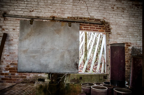
We noticed that the bale building had large hydrant valves similar to the pond up the hill. Joe said that the pond was used for fire suppression. Rather than a water tower, they had the pond at a higher elevation.

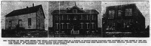
I asked about churches and schools. Joe said that one of the cottages was used as a one-room school. Apparently that didn’t last long. According to a 1919 article in the Charlotte Observer, after the number of students outgrew the one-room school classes were held on the second floor of the company store. Not long after that students were sent to a new school in Hildebrande, just a couple of miles away.
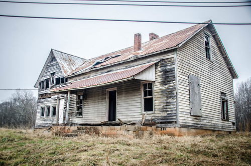
Joe talked about the current state of the village and the amount of vandalism taking place. In addition to spray painting, there had been theft of artifacts from the store and a couple of houses. There had been a large two-story house next to the store that had served as a boarding house. That was burned down either by carelessness or arson a few years back. Joe said that they had to spray water on the store to keep it from combustion. Since Wade Shepherd’s death the site’s status was even more dubious. Even as we were speaking more tourists were arriving and wandering freely around the site, including one family with metal detectors.
We expressed our thanks to Joe for his graciousness and information. I think he would have been happy talking to us about the mill all day. Alan and I continued on our trek, following the loop road that runs behind the houses.
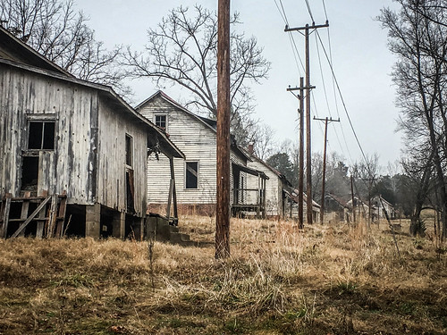

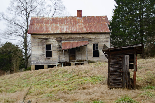
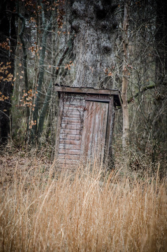
From this angle the number of out houses really stuck out. These houses had no indoor plumbing. Now that I think about it, I didn’t see a sink or bathroom in any of them. According to the Images of America book there was a common well. The book also said that one poor soul’s job was to clean out the outhouses on a regular basis. When one was completely full, they would just dig another hole and move it.
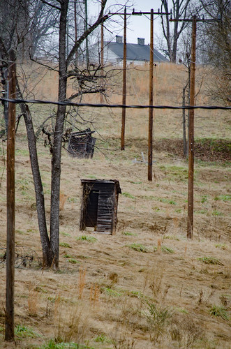
What really bothers me about this is that these houses were occupied well into the 1970s with no modern conveniences. It’s as if the company really didn’t want to be bothered with providing their workers with sanitary living conditions. I think back to the mill villages in South Carolina and I can’t think of any that didn’t provide these services for the mill houses. The last occupant left in 1987, long after the mill had burned.
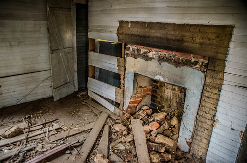
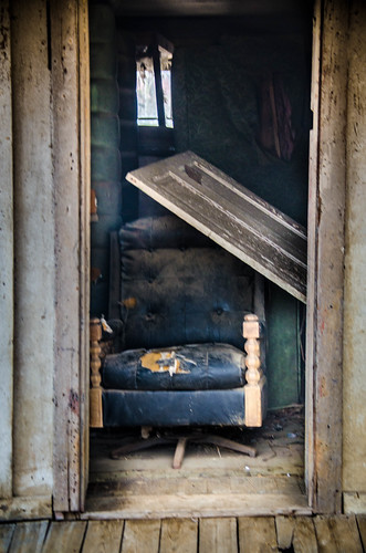
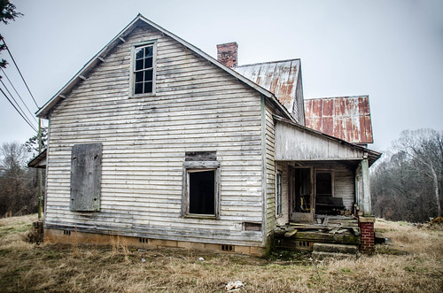
On the east side of the village there were smaller cottages. These just had a couple of rooms and an upstairs. Most of these were in very said shape. In some cases chimneys and fireplaces had collapsed. Most of the stairs were gone, too, and we didn’t attempt to go upstairs in those that remained.

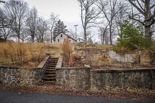
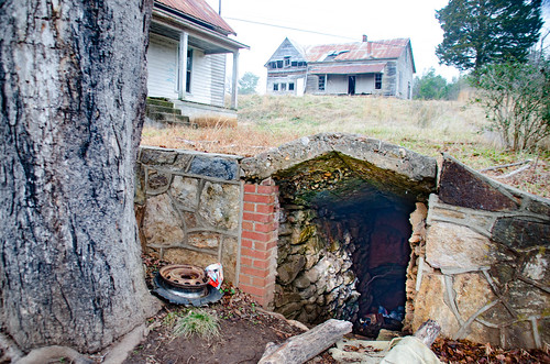
We continued on up the hill. At the top of the hill on the other side of the main road were two much larger houses. The lower one had what looked like either a storm cellar or root cellar.

We made our way back down the hill toward the company store. Traffic was fairly heavy on the main road. All along the way we took more photos of the village and the houses.


When we got back to the car the parking area next to the store was full. Between the vandalism and being loved to death because of the movie, I had to wonder how much longer this place could survive.
When we set out I thought we would only be here 20-30 minutes, then move on to one of the other places I had marked on the map. We were here for much, much longer. There was more to see and explore than I had imagined, and meeting Joe Cline was like discovering gold. He even gave us his phone number, should we ever want to return. It turned out to be an excellent trip.
Alan and I left the mill village and headed west on US 70, paralleling I-40. Our plan was to have lunch in Morganton, then visit the Burke County Museum and see if we could find out more about the village. Alas, over lunch we discovered that the museum was closed for MLK Day. We headed home down US 64, which took us past the South Mountains. All along the way we saw some very intriguing spots, and were tempted to stop and explore. However, it was couldy and misty outside, and not the best for photography and exploration. Plus, I had to get back for a rehearsal that evening. Those places would have to wait for another day’s exploration.
My album of photos from the trip can be seen here:
Alan’s photos are on his Flickr page here:
UPDATE: It seems that shortly after our visit the entire site was made off-limits. New “No Trespassing” signs were posted, including one plastered on top of the sign that seemed to welcome folks to the site of the Hunger Games movie. The photo below was posted on January 26 by Hickory, NC photographer Shane Greene on Facebook.
My junior year roommate was an extra in the film. He lives in Dillsboro where other filming took place.
It was worth the drive, especially because of Joe Cline.
I loved your article and would love to see if I can get a hold of Joe cline im headed there in 3 weeks please email me
Today most of the village s original buildings remain sited along a small gorge of the Henry River, just west of Catawba County, North Carolina.